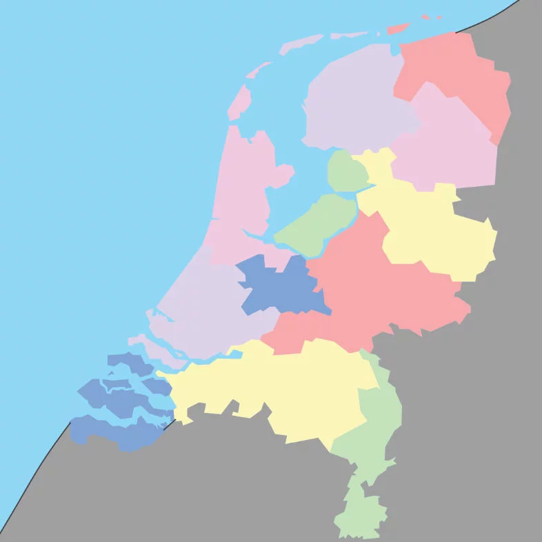
12 provinces = region with own government and capital
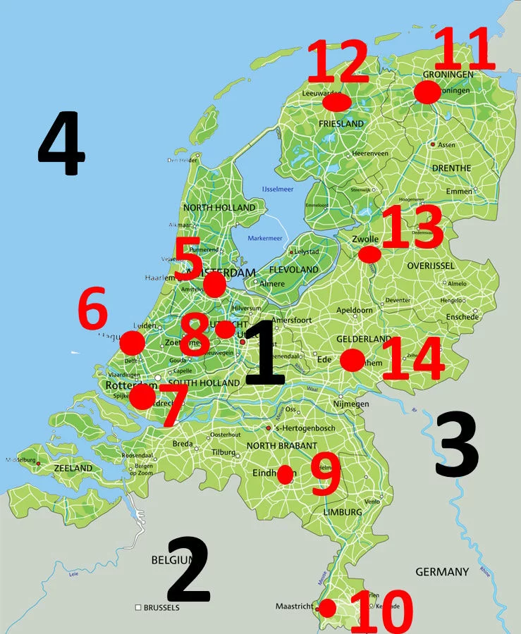
The Netherlands on the map
The Netherlands is a small country. It is much smaller than, for example, Morocco and Turkey. If you drive the car from north to south it is about 300 kilometers and from east to west it is about 180 kilometers. The highest point is
You can also see the provinces on the map by means of the colored regions. A province is an area with its own government. The Netherlands has twelve provinces and each province has its own capital. On a separate map all provinces are indicated.
Of course you don’t need to know all those names. But you do need to know in which city and province you live. They can ask about it on an exam.
At least you should know the names of the big cities like Amsterdam, The Hague, Rotterdam and Utrecht. Together they form an area that is called “Randstad“.
Can you indicate on the map in which province you are now?
The names of the provinces are: Groningen, Friesland, Drenthe, Overijssel, Gelderland, Utrecht, Flevoland, Noord-Holland, Zuid-Holland, Noord-Brabant, Zeeland, Limburg
12 provinces = region with own government and capital
As you can see, the Netherlands is located on the North Sea and has two neighboring countries, namely Germany in the east and Belgium in the south.
1. Nederland2. België3. Duitsland4. Noordzee5. Amsterdam6. Den Haag7. Rotterdam